Overview
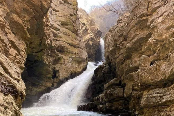
Mirusha/Miruša waterfalls were declared a Regional Nature Park in 1982/83. by the municipalities of Klina and Rahovec/Orahovac, and now they have been inherited by the municipality of Malishevë/Mališevo with an area of 555,80,70 ha. The Government of the Republic of Kosovo made a decision in 2012 to declare the Mirusha/Miruša waterfall a natural monument of special importance with a total area of 598.4 ha. In the lower part of its course, the Mirusha/Miruša River passes through a gorge known as the Mirusha/Miruša River Canyon. In this part of the canyon there are 16 waterfalls with lakes that make up the most attractive part of the canyon. The area is also suitable for various activities such as climbing, kayaking (across the White Drin River), fishing, cycling, etc.
Georeference: 42.523936 20.582317
Category: Natural Assets
Subcategory: Lake
Legal Status of Protection: Category: Natural Monument. Code: MN_082
Is it used for tourism?: Yes
If not, is there potential for tourism in the future?: /
Road infrastructure to the location: Partially paved
Marking and orientation to the location: There are no road signs
Tables on site: There is no table at all
Get Directions
Visited 195 times, 1 Visit today
 në Budakovë 2007")

. në Savrovë 2007")